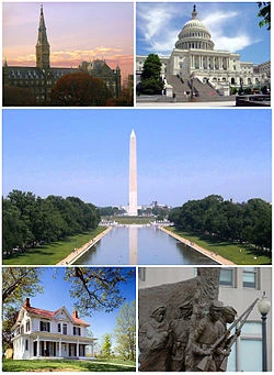
Washington, D.C., formally the District of Columbia and commonly referred to as Washing
ton, "the District," or simply D.C., is the capital of the United States. On July 16, 1790, the Residence Act approved the creation of a capital district located along the Potomac River on the country's East Coast. As permitted by the U.S. Constitution, the District is under the exclusive jurisdiction of the United States Congress and is therefore not a part of any U.S. state.
History[]
Main article: History of Washington, D.C. An Algonquian-speaking people known as the Nacotchtank inhabited the area around the Anacostia River when the first Europeans arrived in the 17th century.[3] However, the Nacotchtank people had largely relocated from the area by the early 18th century.[4]
In his "Federalist No. 43," published January 23, 1788, James Madison argued that the new federal government would need authority over a national capital to provide for its own maintenance and safety.[5] Five years earlier, a band of unpaid soldiers besieged Congress while its members were meeting in Philadelphia. Known as the Pennsylvania Mutiny of 1783, the event emphasized the need for the national government not to rely on any state for its own security.[6]
Article One, Section Eight of the United States Constitution therefore permits the establishment of a "District (not exceeding ten miles square) as may, by cession of particular states, and the acceptance of Congress, become the seat of the government of the United States."[7] However, the Constitution does not specify a location for the capital. In what is now known as the Compromise of 1790, Madison, Alexander Hamilton, and Thomas Jefferson came to an agreement that the federal government would pay each state's remaining Revolutionary War debts in exchange for establishing the new national capital in the Southern United States.
Geography[]
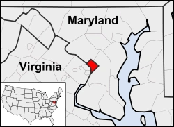
Washington, D.C., is located in the mid-Atlantic region of the U.S. East Coast. Due to the District of Columbia retrocession, the city has a total area of 68.3 square miles (177 km2), of which 61.4 square miles (159 km2) is land and 6.9 square miles (18 km2) (10.16%) is water.[41] The District is bordered by Montgomery County, Maryland to the northwest; Prince George's County, Maryland to the east; and Arlington and Alexandria, Virginia to the south and west.
The Potomac River forms the District's border with Virginia and has two major tributaries: the Anacostia River and
Rock Creek.[42] Tiber Creek, a natural watercourse that once passed through the National Mall, was fully enclosed underground during the 1870s.[43] The creek also formed a portion of the now-filled Washington City Canal, which allowed passage through the city to the Anacostia River from 1815 until the 1850s.[44] The Chesapeake and Ohio Canal starts in Georgetown and was used during the 19th century to bypass the Great Falls of the Potomac River, located upstream (northwest) of Washington at the Atlantic Seaboard fall line.[45]
The highest natural elevation in the District is 409 feet (125 m) above sea level at Fort Reno Park in upper northwest Washington.[46] The lowest point is sea level at the Potomac River.[47] The geographic center of Washington is near the intersection of 4th and L Streets NW.[48] Contrary to the urban legend, Washington was not built on a reclaimed swamp, but wetlands did cover areas along the water.[49][50]
The District has 7,464 acres (30.21 km2) of parkland, about 19% of the city's total area and the second-highest percentage among high-density U.S. cities.[51] The National Park Service manages most of the 9,122 acres (36.92 km2) of city land owned by the U.S. government.[52] Rock Creek Park is a 1,754-acre (7.10 km2) urban

forest in Northwest Washington, which extends 9.3 miles (15.0 km) through a stream valley that bisects the city. Established in 1890, it is the country's fourth-oldest national park and is home to a variety of plant and animal species including raccoon, deer, owls, and coyotes.[53] Other National Park Service properties include the C&O Canal National Historical Park, the National Mall and Memorial Parks, Theodore Roosevelt Island, Columbia Island, Fort Dupont Park, Meridian Hill Park, Kenilworth Park and Aquatic Gardens, and Anacostia Park.[54] The D.C. Department of Parks and Recreation maintains the city's 900 acres (3.6 km2) of athletic fields and playgrounds, 40 swimming pools, and 68 recreation centers.[55] The U.S. Department of Agriculture operates the 446-acre (1.80 km2) U.S. National Arboretum in Northeast Washington
Demographics[]
Main article: Demographics of Washington, D.C.
The U.S. Census Bureau estimates that the District's population was 632,323 on July 1, 2012, a 5.1% increase since the 2010 United States Census.[1] The increase continues a growth trend since 2000, following a half-century of population decline.[82] The city was the 24th most populous place in the United States as of 2010.[83] According to data from 2009, commuters from the suburbs increase the District's daytime population to over one million people.[84] If the District were a state it would rank 49th in population, ahead of Vermont and Wyoming.
The Washington Metropolitan Area, which includes the District and surrounding suburbs, is the seventh-largest metropolitan area in the United States with an estimated 5.7 million residents in 2011.[2] When the Washington area is included with Baltimore and its suburbs, the Baltimore–Washington Metropolitan Area had a population exceeding 8.5 million residents in 2010, the fourth-largest combined statistical area in the country.[85]
According to the 2010 Census, the population of Washington, D.C., was 50.7% Black or African American, 38.5% White (34.8% non-Hispanic White), 3.5% Asian, and 0.3% Native American. Individuals from other races made up 4.1% of the District's population while individuals from two or more races made up 2.9%. Hispanics of any race made up 9.1% of the District's population.[86]
Washington has had a significant African American population since the city's foundation.[87] African American residents composed about 30% of the District's total population between 1800 and 1940.[26] The black population reached a peak of 70% by 1970, but has since steadily declined due to many African Americans moving to the surrounding suburbs. Partly as a result of gentrification, there was a 31.4% increase in the non-Hispanic white population and an 11.5% decrease in the black population between 2000 and 2010.[88]
About 17% of D.C. residents were age 18 or younger in 2010; lower than the U.S. ave

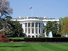
The White House
rage of 24%. However, at 34 years old, the District had the lowest median age compared to the 50 states.[89] As of 2010, there were an estimated 81,734 foreign immigrants living in Washington, D.C.[90] Major sources of immigration include individuals from El Salvador, Vietnam, and Ethiopia, with a concentration of Salvadorans in the Mount Pleasant neighborhood.[91]
Researchers found that there were 4,822 same-sex couples in the District of Columbia in 2010; about 2% of total households.[92] Legislation authorizing same-sex marriage passed in 2009 and the District began issuing marriage licenses to same-sex couples in March 2010.[93]
A 2007 report found that about one-third of District residents were functionally illiterate, compared to a national rate of about one in five. This is attributed in part to immigrants who are not proficient in English.[94] In contrast, 50% of D.C. residents had at least a four-year college degree in 2006.[90] D.C. residents had a personal income per capita of $55,755; higher than any of the 50 U.S. states.[95] However, 19% of residents were below the poverty level in 2005; higher than any state except Mississippi.[96]
According to data from 2008, 28% of residents are Baptists, 13% are Roman Catholic, and 31% are members of other Christian denominations. Residents who practice other faiths make up 6% of the population and 18% do not adhere to a religion.[97]

Over 90% of D.C. residents have health insurance coverage; the second-highest rate in the nation. This is due in part to city programs that help provide insurance to low-income individuals who do not qualify for other types of coverage.[98] A 2009 report found that at least 3% of District residents have HIV or AIDS, which the U.S. Centers for Disease Control and Prevention (CDC) characterizes as a "generalized and severe" epidemic.
Sister cities[]
Washington, D.C., has thirteen official sister city agreements. Each of the listed cities is a national capital except for Sunderland, which includes the town of Washington, the ancestral home of George Washington's family. Paris and Rome are each formally recognized as a "partner city" due to their special one sister city policy.

Source: Wikipedia, the free encyclopedia